Tung Ping Chau Hong Kong: Ferry, Speedboat & Island Transport Guide
Tung Ping Chau is one of Hong Kong’s most distinctive remote islands, known for its flat rock formations, clear coastal scenery and distance from the city. This guide explains practical transport options, ferry limitations, private speedboat access and weather planning before visiting.
Quick Answer
Tung Ping Chau can usually be reached by public ferry on selected schedules, but weekday or flexible-time visits may require private boat or speedboat arrangement. Because the island is located in exposed northeast waters, weather and wind direction are important when planning a trip.
Why Tung Ping Chau Is Different
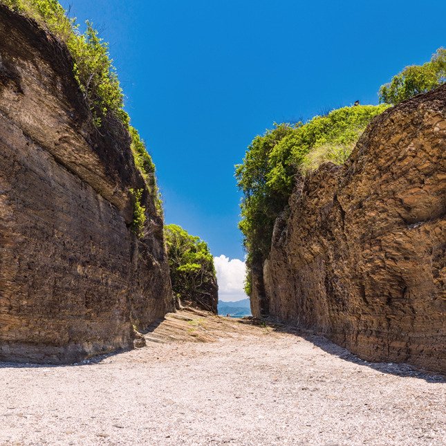
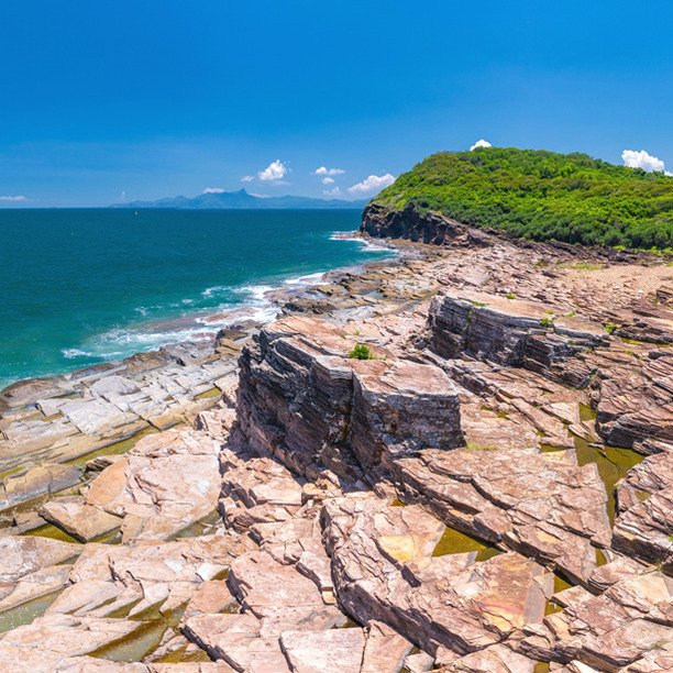
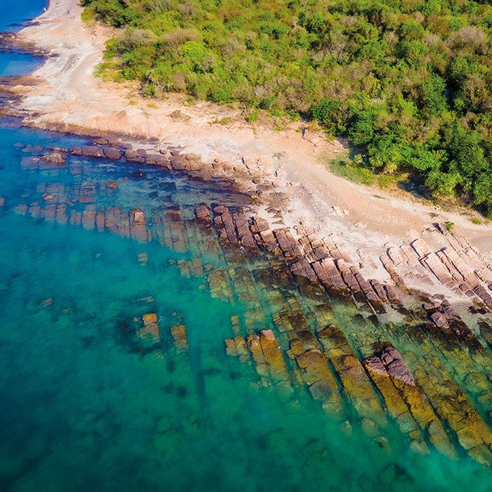
Tung Ping Chau is far from the main urban areas and has a very different feeling from typical beaches or short island trips in Hong Kong. The island is famous for its layered rock formations, coastal walking routes and open sea scenery.
Because of its location, visiting Tung Ping Chau requires better planning than many other islands. Transport schedule, return time, sea condition and group arrangement should all be checked before confirming a trip.
SKR focuses on realistic access planning rather than overselling the destination. If weather or route conditions are not suitable, choosing another island may be the better option.
Best For
- Remote island day trips
- Coastal geology scenery
- Quiet island walking routes
- Small group exploration
- Photography and nature trips
- Flexible private boat planning
Tung Ping Chau Transport Options
The best way to get to Tung Ping Chau depends on your date, group size, timing flexibility and weather conditions.
Public Ferry
Suitable when the official ferry schedule matches your plan and you are comfortable following fixed departure and return times.
Best for: budget trips, fixed schedule visitors.
Speedboat Access
Useful for more flexible timing, group movement and private access when public transport is not suitable.
Best for: small groups, weekday planning, flexible trips.
Private Boat Arrangement
Suitable for teams, custom schedules, marine activities or groups that need more control over time and route.
Best for: groups, field teams, photography, NGOs.
Weather & Marine Conditions Matter
Tung Ping Chau is located in northeast Hong Kong waters, so wind direction and seasonal conditions can affect the journey significantly. Sunny weather does not always mean the sea is calm.
Before confirming a trip, it is better to check wind direction, wave condition, route exposure and whether the landing arrangement is suitable.
When Is Tung Ping Chau Calm?Check Before You Go
- Wind direction
- Wave and swell level
- Departure point suitability
- Return time and daylight
- Group size and comfort level
- Public ferry or private boat availability
How to Plan a Tung Ping Chau Trip
Choose Your Date
Check whether your date matches ferry availability or requires private boat arrangement.
Check Marine Conditions
Wind and sea condition are especially important for northeast island routes.
Confirm Group Size
Boat cost and arrangement depend heavily on the number of passengers.
Plan Return Time
Remote island trips should avoid unrealistic return timing, especially in changing weather.
Frequently Asked Questions
How do I get to Tung Ping Chau?
You may use public ferry when the schedule matches your plan. For flexible timing, weekday access or group arrangement, private boat or speedboat options may be considered.
Is Tung Ping Chau suitable for weekday trips?
Weekday trips may be possible, but they require more planning because public transport options can be limited. Private boat arrangement may be more suitable for flexible weekday access.
Is the sea rough to Tung Ping Chau?
It depends on wind direction, season and wave conditions. Northeast waters can be affected by monsoon and open sea exposure, so checking marine conditions is important.
Planning a Tung Ping Chau Trip?
Tell us your date, group size and preferred timing. SKR can help you check whether ferry, shared boat or private speedboat arrangement is more suitable.