Port Island Hong Kong: Red Rock Coast & Island Transport Guide
Port Island is one of Hong Kong’s most distinctive remote islands, known for its red sedimentary rock coastline and exposed northeast waters. This guide explains practical transport options, speedboat access and marine conditions before planning a trip.
Quick Answer
Port Island does not have regular public ferry service like larger Hong Kong islands. Most visitors access the island by private speedboat or custom island transport arrangement, usually depending on weather, sea conditions and departure point availability.
Why Port Island Is Different
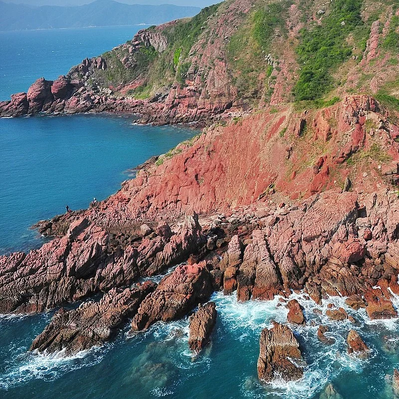
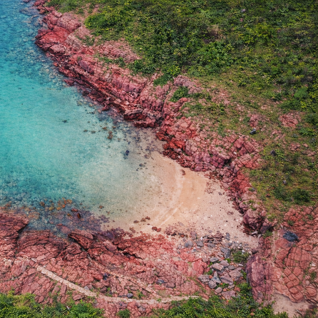
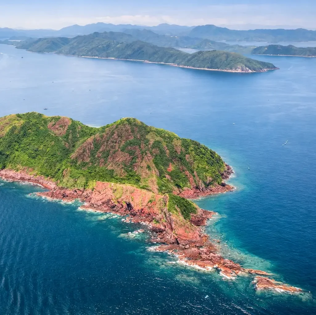
Port Island is famous for its striking red sedimentary rock coastline and remote northeast Hong Kong scenery. Unlike larger tourist islands, the area remains relatively undeveloped and depends heavily on marine access.
The island is commonly visited together with nearby geological coastal locations and small offshore islands. Weather and sea conditions can affect route comfort significantly because the area faces open northeast waters.
Many visitors choose Port Island for photography, geological scenery and remote coastal exploration rather than traditional beach tourism.
Best Known For
- Red sedimentary rock coastline
- Remote northeast island scenery
- Open sea coastal landscapes
- Photography & exploration trips
- Geological formations
- Private speedboat island routes
Port Island Transport & Boat Access
Most Port Island trips require private marine transport planning because the island has no standard public ferry access.
Private Speedboat
Flexible option for small groups visiting remote northeast island routes and geological coastal areas.
Island Hopping Routes
Port Island is often combined with nearby northeast islands and coastal exploration points during the same trip.
Flexible Departure Points
Departure location may change depending on sea condition, route design and operator arrangement.
Marine Conditions Matter for Port Island
Port Island is located in exposed northeast Hong Kong waters where wind and swell can affect route comfort significantly.
Sunny weather does not always mean smooth sea conditions. Wind direction and seasonal swell are often more important for small boat comfort.
Route planning should consider marine forecast, exposure level and suitable weather windows before confirming transport.
Important Planning Factors
- Wind direction
- Wave & swell conditions
- Northeast monsoon
- Departure point suitability
- Passenger comfort level
- Landing conditions
Frequently Asked Questions
How do I get to Port Island?
Most visitors reach Port Island through private speedboat or custom island transport arrangement from northeast Hong Kong departure points.
Does Port Island have public ferry service?
No standard public ferry route operates directly to Port Island like larger populated islands.
Is Port Island suitable during rough weather?
Marine conditions can affect comfort significantly because the island is exposed to northeast waters. Route planning should consider wind and swell carefully.
Planning a Port Island Trip?
Tell us your preferred date, group size and route idea. SKR can help check marine conditions, transport feasibility and suitable speedboat arrangement.